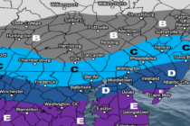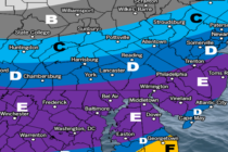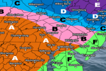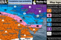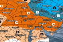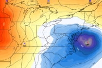
Active Pattern Continues
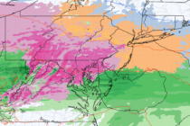
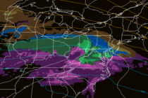
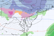
Discussion: We’re in the middle of a six, potentially seven, system onslaught. Three of them have passed, the two snow-to-ice-to-rain systems last week and last night’s CNJ/SNJ event. The next two (system #4 and #5) are also wintry-to-non-wintry systems and