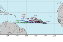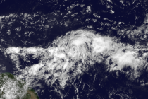
Aug 20: Hurricane Danny has Formed!
Hurricane Danny, per latest data, has intensified down to a 992mb low pressure center. Sustained max winds are now up to 75mph. He is currently moving towards the NE region of the Caribbean as most model guidance suggested over the last 48-72