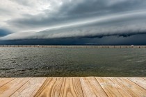
Unsettled Weekend Expected (April 21-23)
Not a total washout. Some of it looks alright… Disco: As far as temperatures go, we’re warm-sectored on Friday and cold-slotted on Sunday leaving Saturday as a slightly drier day of transition. Every day of the weekend is subject to