Nasty Start. Improvement Expected Sunday
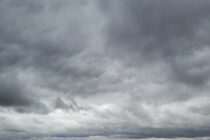
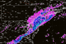
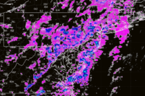
Discussion: Isn’t it funny how you can go all of March without wintry precipitation (most areas) and then have to deal with some in April? It’s downright nasty outside right now. Cold and rainy and that should be the case