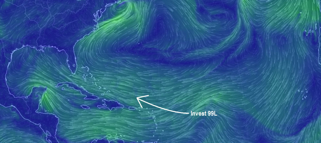
Franklin has made landfall on the Yucatan Peninsula and will re-emerge over the SW Gulf of Mexico before making another landfall on the E coast of Mexico. No impacts to New Jersey or even the US are expected from such. Invest 99L however is something we need to keep an eye on.
Invest 99L is an area under investigation by the National Hurricane Center. Any further strengthening and it will become a tropical depression. Once sustained winds of 39mph or greater around an organized low-level circulation are found, it would then become Tropical Storm Gert. We’re not there yet but the overnight Euro model as well as its ensemble members were a bit concerning for the east coast. The GFS is not seeing it so we have very inconsistent data.
As far as live observations, the Bermuda High is kicking and could provide the right steering mechanism to bring this system up the coast. The stronger Invest 99L becomes, the more S of a track it will have. If it stays weak then it would likely re-curve out-to-sea. So I will be watching how rapid any intensification becomes over the next few days as well as the position of the Bermuda High and other steering factors. Here are the latest GFS ensemble members indicating a concerning path for Invest 99L, especially if intensification were to occur:
In English: Right now a very weak tropical system is heading towards the NE Caribbean Sea area. The system is expected to pass just to the NE of Puerto Rico. I’m very much hoping that the system stays weak and misses us out to sea. We do however need to consider the possibility of this tropical system strengthening into something stronger and impacting the US east coast in the August 15-17 time window. The European model showed this overnight however the GFS keeps the system a weak non-issue. Live observations indicate that the steering mechanisms are there for east coast impact however do not yet speak to how intense this tropical system of interest could become. There is no need to panic yet! If my discussion of possibilities panics you then you should come back in a few days when there is more certainty. This now has my full attention however until I’m confident in a miss out-to-sea. I will take great pleasure in a few days if I’m able to report an expected miss out-to-sea. We’re not there yet however and therefore I will discuss. Please be safe! JC
Jonathan Carr (JC) is the founder and sole operator of Weather NJ, New Jersey’s largest independent weather reporting agency. Since 2010, Jonathan has provided weather safety discussion and forecasting services for New Jersey and surrounding areas through the web and social media. Originally branded as Severe NJ Weather (before 2014), Weather NJ is proud to bring you accurate and responsible forecast discussion ahead of high-stakes weather scenarios that impact this great garden state of ours. All Weather. All New Jersey.™ Be safe! JC
