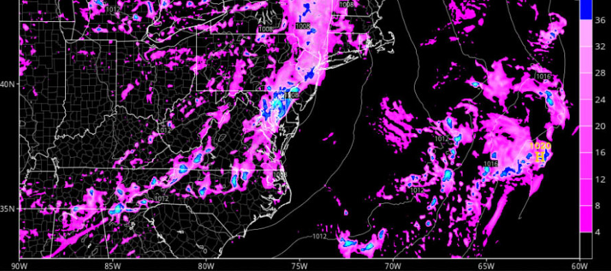
Aug 21: Rain and Thunderstorms Approaching

A strong cold front is pushing through the Mid-Atlantic US. It is currently still back in PA but should push completely through New Jersey between later tonight and tomorrow. By tomorrow afternoon/evening, noticeable relief should be felt. By Tuesday morning, it should feel like Fall. It will be absolutely amazing but first we have to get through the rain and thunderstorms that could form ahead/along the cold front later this afternoon-tonight.
Short-range guidance soundings aren’t really screaming anything crazy. Both instability and wind shear appear marginal but sufficient. The trigger is obviously the cold front and the strongest ingredient in the equation. Therefore, I at least expect a 1-2 hour period of moderate-to-heavy rainfall with embedded thunderstorm action. Should wind gusts exceed 58mph and/or hail reaches 1-inch or greater in diameter, then severe thunderstorm warnings will be triggered. So yes, severe criteria is possible along this cold frontal passage tonight but not guaranteed for everyone. Once the rain and storm potential is through, we’ll need overnight and some of tomorrow morning for the actual cold front to pass through all of New Jersey. Again, after this we should get a true first taste of fall tomorrow evening into Tuesday.
In English: Expect muggy and breezy conditions out of the S today ahead of the rain and storms. Skies should be mixed with sun and clouds. Rain and storms should hit western parts of New Jersey as early as 4/5PM and should clear the Jersey coast by 10/11PM. Rain, wind and some lightning/thunder is the most likely scenario. Severe criteria is possible and will have to be now-casted. The cold front should then move through between tonight and the first half of tomorrow. Tomorrow should gradually improve as humidity decreases. Tomorrow night we should dip into the 50s going into Tuesday.. I’ll have the full Monday-Friday Outlook posted later this evening. Have a great Sunday and be safe! JC
Jonathan Carr (JC) is the founder and sole operator of Weather NJ, New Jersey’s largest independent weather reporting agency. Since 2010, Jonathan has provided weather safety discussion and forecasting services for New Jersey and surrounding areas through the web and social media. Originally branded as Severe NJ Weather (before 2014), Weather NJ is proud to bring you accurate and responsible forecast discussion ahead of high-stakes weather scenarios that impact this great garden state of ours. All Weather. All New Jersey.™ Be safe! JC


