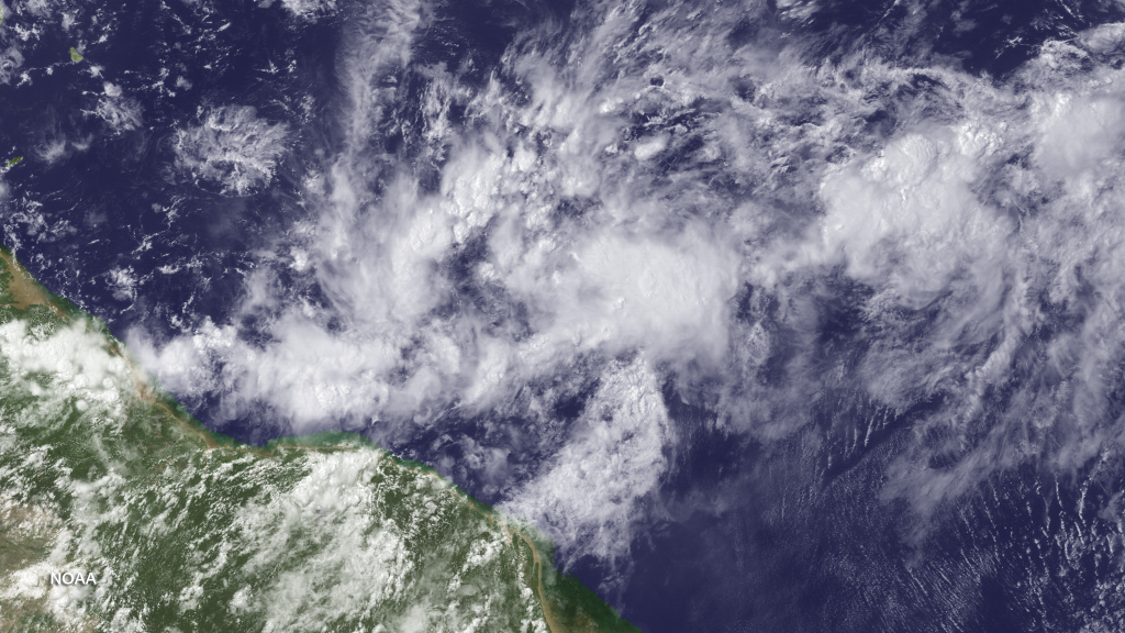
Tropical development is expected just east of the Windward Islands of the Lesser Antilles. At this point it’s fairly certain that this will move behind the Leeward Islands and into the Eastern Caribbean Sea under the name Cristobal (if Tropical Storm criteria is met). As far as New Jersey goes, we have to wait and see what happens after this system interacts with the Northern Caribbean Islands. Higher elevations, like in Hispaniola for example, are known to weaken systems as they pass over.
The big question (if it holds together)…which side of Florida will it track, if not a direct FL hit? There are no scientific methods that can produce any level of certainty beyond Haiti and the Dominican Republic region. The important thing to focus on right now is the projected track over the next few days, not the longer range solutions that are spraying anywhere from Texas to the east coast.
Let’s look at some model guidance. This is commonly known as a spaghetti plot. It represents all the tropical model output on a single model image. Historically it’s a safe bet to take the mean track of these model plots over the next 48-72 hours. 96 hours and beyond is a gamble with current Atlantic Ocean dynamics. With that being said it’s again, fairly certain that this tropical system will develop and head into the Eastern Caribbean Sea threatening the Northern Caribbean Islands. Here’s the latest spaghetti plot from WeatherBell Analytics:
Images from NOAA and WeatherBell Analytics.
Jonathan Carr (JC) is the founder and sole operator of Weather NJ, New Jersey’s largest independent weather reporting agency. Since 2010, Jonathan has provided weather safety discussion and forecasting services for New Jersey and surrounding areas through the web and social media. Originally branded as Severe NJ Weather (before 2014), Weather NJ is proud to bring you accurate and responsible forecast discussion ahead of high-stakes weather scenarios that impact this great garden state of ours. All Weather. All New Jersey.™ Be safe! JC
