Rain is already approaching the Washington D.C./Baltimore area from the W/SW. At it’s current pace it should arrive in New Jersey by sunrise if not earlier. I’m starting to get a better idea of how this system is going to play out. It should pretty much wash out tomorrow but clear by noon on Wednesday, if not earlier. I’m thinking inches of rainfall will be the main headline here, not thunderstorms. Although embedded thunderstorms are possible within the widespread rainfall, higher winds should be kept in check by lack of instability and marginal wind shear values…it could still get gusty but there’s a less chance of severe criteria being met. There are better wind parameters to our north (NY/New England). Let’s look at some current obs and short-range model guidance.
As you can see precipitation is approaching the region. A low pressure disturbance will be passing through, from west to east, just to our north. This will create multiple frontal passages that moisture will basically surf to the coast. Here’s the current front end of precipitation on radar:
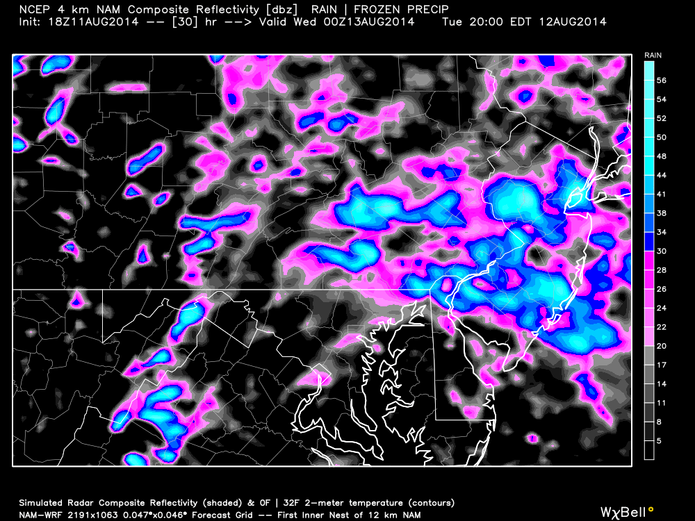
The high-res short-range NAM is indicating the heaviest concentration of rainfall between 8pm and midnight tomorrow night (8PM shown below). Multiple inches of much-needed rain are expected to fall:
In English: Expect scattered showers to form overnight tonight and slowly pick up in intensity towards tomorrow evening. Widespread heavy rainfall and scattered thunderstorms are then expected into the early AM hours of Wednesday with a target clearing time of noon. Again, rainfall will be the headline not the embedded isolated-scattered storms. Be safe! JC
Jonathan Carr (JC) is the founder and sole operator of Weather NJ, New Jersey’s largest independent weather reporting agency. Since 2010, Jonathan has provided weather safety discussion and forecasting services for New Jersey and surrounding areas through the web and social media. Originally branded as Severe NJ Weather (before 2014), Weather NJ is proud to bring you accurate and responsible forecast discussion ahead of high-stakes weather scenarios that impact this great garden state of ours. All Weather. All New Jersey.™ Be safe! JC
