Aug 10: Widespread Rainfall Detected!
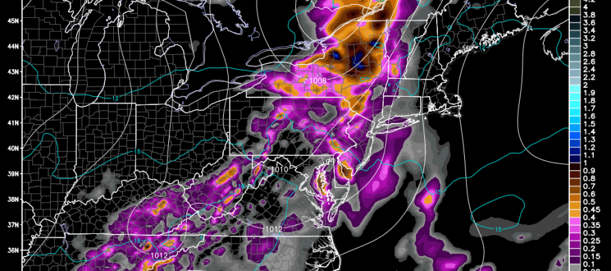
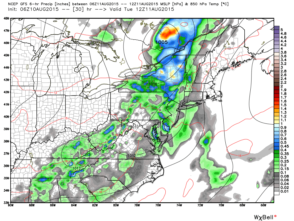
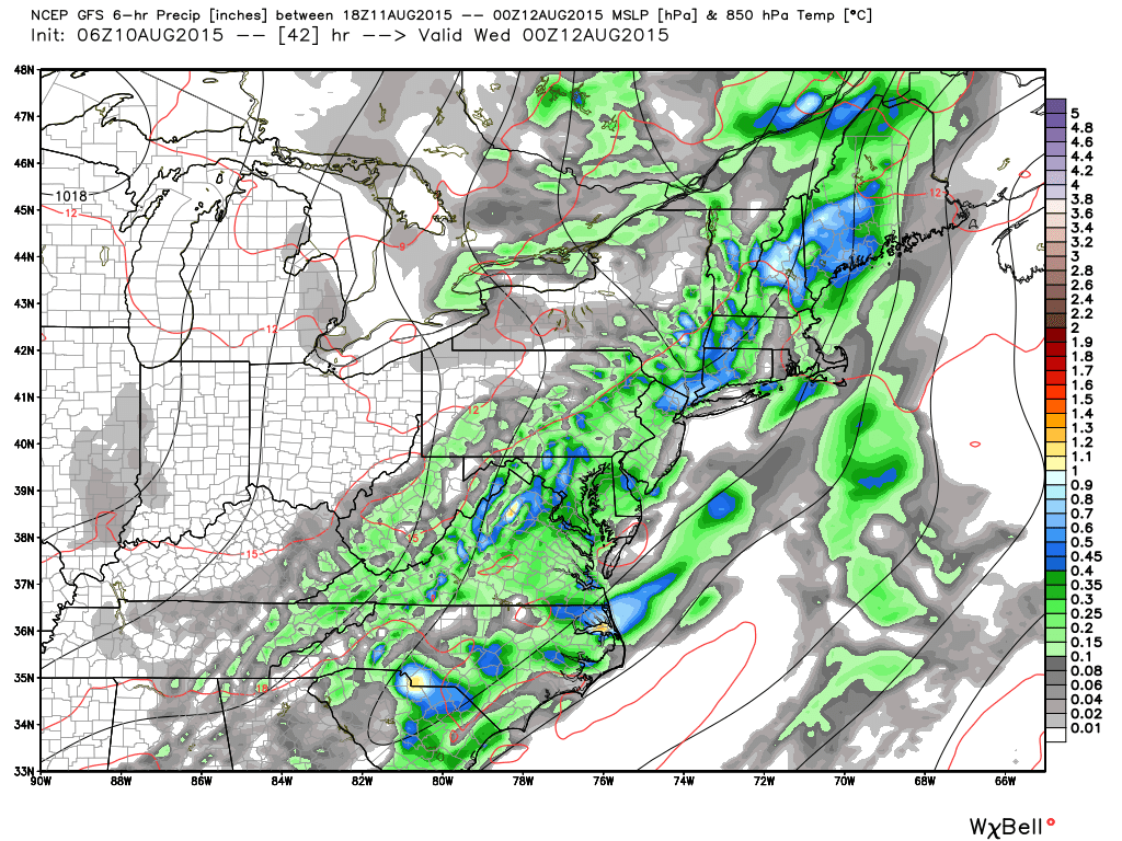
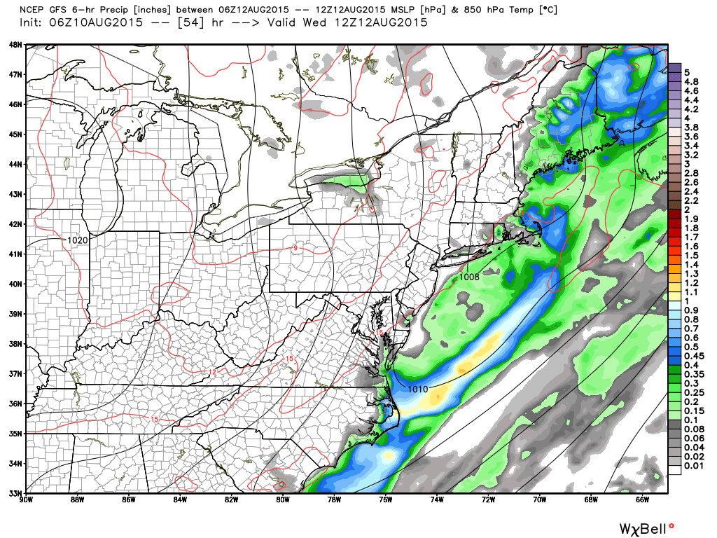
A low pressure disturbance will track through the Great Lakes/NY State region tomorrow before continuing through the rest of New England. This will help push a series of frontal boundaries through New Jersey today and tomorrow. Not much action is expected along today’s warm front but widespread rainfall is expected ahead of the cold front late tonight well into tomorrow. Let’s look at the latest GFS 850mb map for timing:
Early Tuesday AM Hours:
Tuesday Afternoon-Evening:
Early Wednesday AM Hours:
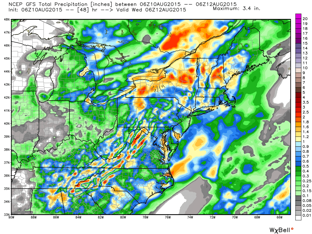
Total Precipitation through Wednesday AM:
In English: There exists only a small chance of isolated showers and thunderstorms today. Most of us should see a dry day. The heaviest rainfall should occur between later tonight and tomorrow night. My gut tells me that between .5 and 1.5 inches of rain should fall when all is said and done. Also, embedded thunderstorms are possible within the rainfall but should stay below severe criteria (isolated rolling thunder). Everything should clear out by late Wednesday morning as the cold front pushes through for a couple of Fall-tasting days (cooler temperatures, lower humidity and NW flow) heading into the weekend. Be safe! JC
Model images used with permission from WeatherBell Analytics.
Jonathan Carr (JC) is the founder and sole operator of Weather NJ, New Jersey’s largest independent weather reporting agency. Since 2010, Jonathan has provided weather safety discussion and forecasting services for New Jersey and surrounding areas through the web and social media. Originally branded as Severe NJ Weather (before 2014), Weather NJ is proud to bring you accurate and responsible forecast discussion ahead of high-stakes weather scenarios that impact this great garden state of ours. All Weather. All New Jersey.™ Be safe! JC


