Nov 4: Arctic Outbreak Detected!

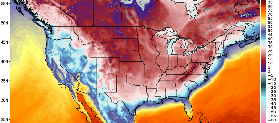
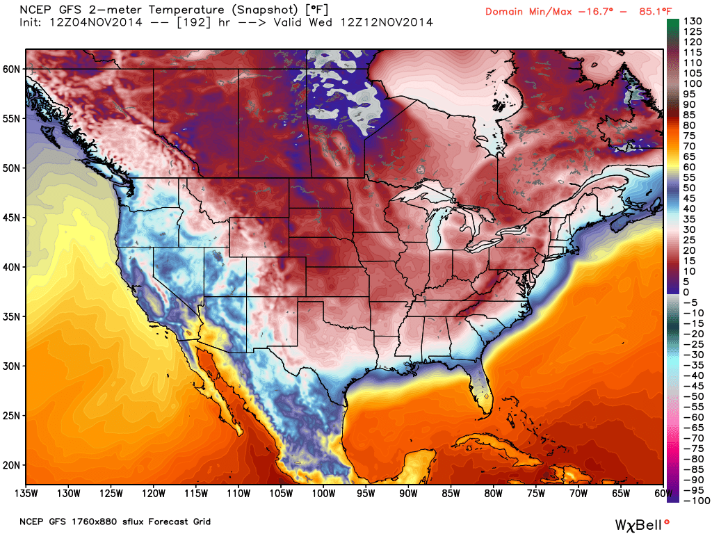
So we’ll finish out our beautiful and mild temperatures today and tomorrow followed by a low pressure disturbance (rain and wind) Thursday night into Friday. Saturday and a good part of Sunday look dry but windy and cool. Another low pressure disturbance could disrupt the region Sunday night through Monday with some light rain but then it’s coming…an Arctic air mass will spill down over Canada and impact the central and eastern US later next week. Here’s the latest upgraded GFS model showing expected surface temperatures (in degrees Fahrenheit) next Wednesday morning:
As you can see New Jersey is looking at temperatures ranging from ~20-30 and possibly even colder in the higher elevations. This should bring the first widespread freeze to the region. The Ohio Valley is showing temperatures in the single digits and teens. With strong polar flow over the Great Lakes, I wouldn’t be surprised to see the lake effect snow machine kicking for PA and NY State. Regardless, it looks like it will be very cold next week, especially towards the weekend. No moisture associated with this arctic outbreak as of now but I’ll be keeping an eye on that. Have a plan to stay warm and be safe! JC
Jonathan Carr (JC) is the founder and sole operator of Weather NJ, New Jersey’s largest independent weather reporting agency. Since 2010, Jonathan has provided weather safety discussion and forecasting services for New Jersey and surrounding areas through the web and social media. Originally branded as Severe NJ Weather (before 2014), Weather NJ is proud to bring you accurate and responsible forecast discussion ahead of high-stakes weather scenarios that impact this great garden state of ours. All Weather. All New Jersey.™ Be safe! JC


