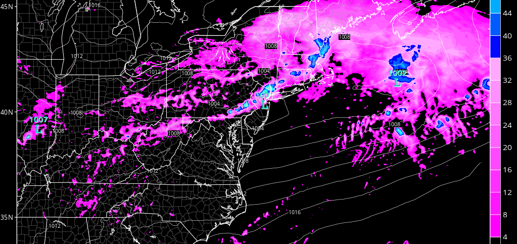
Short-range model guidance continues to suggest a line of thunderstorms moving through New Jersey tomorrow afternoon/evening. This should be sandwiched between spotty showers throughout most of tomorrow. In fact, some initial precipitation could move in overnight tonight. Here’s the latest high-res NAM showing simulated radar tomorrow afternoon (around 2pm):
Tomorrow should be a bizarre temperature profile across New Jersey. NNJ should be almost an entirely different planet than SNJ. The best I can do right now is divide the state in half at I-195 (from Trenton to Wall). North of that might only reach the 50s and 60s. South of that should reach the 70s and 80s. We could see a 30 degree difference between extreme NNJ and extreme SNJ. We can blame the near-stationary frontal boundary draped across our region for this.
I do think that severe thunderstorm criteria is capable of being met (wind gusts > 58mph and quarter-size hail or greater). Lightning doesn’t factor into whether or not the NWS issues severe thunderstorm warnings but I do think frequent lightning is also possible.
Timing is hard to pin down but we’re basically game any time after noon. NWNJ should see action first and SENJ last. That period should be about 3-4 hours for the liner thunderstorm segment to move over all of New Jersey from NW to SE. So whenever it starts in NWNJ, you know how to time from there.
In English: Thunderstorms are possible tomorrow afternoon. They could start any time after noon for NWNJ and should clear SENJ by sunset. They will be moving from NW to SE. Heavy downpours, frequent lightning, and high wind gusts are possible along the expected main line of storms. NNJ should feel like spring with cooler temperatures. SNJ should feel summery with humid highs in the 70s/80s, especially away from the ocean. I’ll see you all during live-casting. Be safe! JC
Jonathan Carr (JC) is the founder and sole operator of Weather NJ, New Jersey’s largest independent weather reporting agency. Since 2010, Jonathan has provided weather safety discussion and forecasting services for New Jersey and surrounding areas through the web and social media. Originally branded as Severe NJ Weather (before 2014), Weather NJ is proud to bring you accurate and responsible forecast discussion ahead of high-stakes weather scenarios that impact this great garden state of ours. All Weather. All New Jersey.™ Be safe! JC
