Weekend Snow Map

Discussion: The chances for much of New Jersey to see snowfall and snow accumulation tomorrow (Friday) night into Saturday morning continue to increase. Let’s break it all down.
Real quick, we saw our rain last night with most of NJ in the .15” to .25” range. A few areas got closer to a half inch mainly across the I-78 area and a few isolated SNJ spots. Much needed and that completes the warmer stretch. Today is a step down colder but still what I would consider mild for snowfall interests. Today, NJ is ranging from upper-30s to upper-40s from NNJ elevations to SNJ coasts. Tonight, we should drop into the 28-36 range. Tomorrow (Friday) should warm up into the 30s and 40s again and that will start the discussion about snowfall.
We’re going to divide NJ right along I-95 from SW to NE. This includes the New Jersey TurnPike for a portion of the state (a separate discussion lol). For now I am going to generally refer to the line drawn from the Delaware Memorial Bridge to the George Washington Bridge as the I-95 corridor through NJ.
Areas along and SE of I-95 are expected to be too warm at the surface for snow to fall and stick through about midnight Friday night. Precip could start as early as afternoon. That means that areas along and SE of I-95 should expect rain for all Friday PM hours. It won’t be until between midnight and about 3am Saturday morning that all areas SE of I-95 become cold enough for snow. Areas NW of I-95 are in a different boat as they will be cold enough for snow to fall both Friday night and Saturday morning. It might be a little toasty if precip starts as early as early Friday afternoon but by sunset or just after, a changeover from rain to snow is expected. So NWNJ (NE of I-95) is a little rain over to mostly snow and SENJ (along and SE of I-95) is mostly rain over to a little snow.
To summarize the synoptics from prior articles leading into this first snow map, we have a decaying N stream clipper system meeting up with an S stream offshore low. The two systems do not fully phase together. If they did, we’d be looking at a much larger snowstorm. Instead, they should only partially interact and establish an axis of lifting between the two while they are closest together (Friday night/Saturday morning). This is the InVerted Trough (IVT) that reaches from the offshore low to the decaying clipper. This area of lifting is what will create the precipitation to fall over crashing surface temperatures between Friday night and Saturday morning.
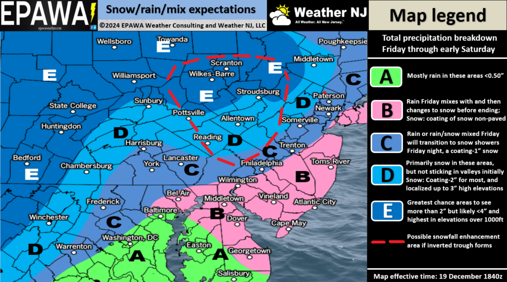
Once the snowfall ends for all areas by mid-to-late Saturday morning, temperatures will continue to plummet. Saturday highs should be held in the 30s and Sunday in the 20s, even for SENJ coasties. Not record, but def brutal cold Saturday evening into Christmas Eve. So any accumulation leftover from our Friday-Saturday system will likely stick around into Christmas Eve. A warmup between Christmas Day and New Year’s Day is still expected just beyond the cold snap with cold air returning just after New Year’s Day. Without further ado, Here is our initial snow impact map for Friday afternoon through Saturday morning.

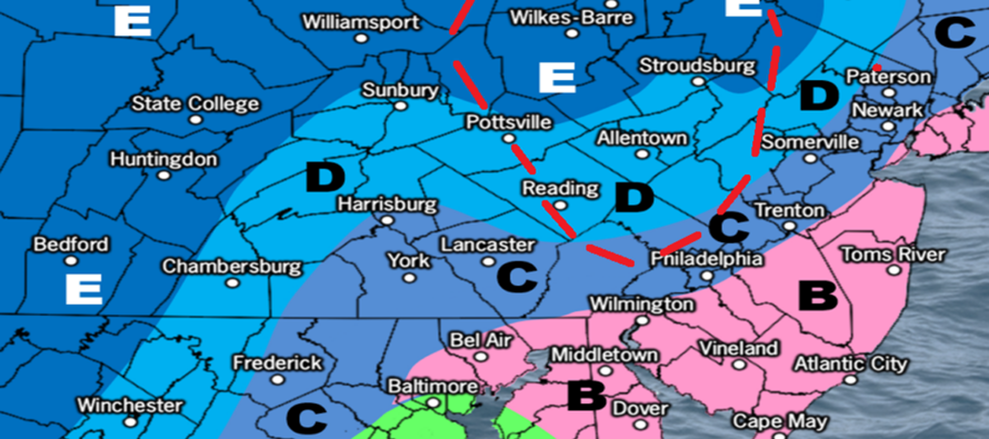
The red-dashed area is where we currently believe the IVT could overperform. Given the unpredictable nature of an IVT, this could change right up until first flakes. But this is the best evidenced-based call we can make at this time and it’s only a maybe. Otherwise, only trace to light accumulations are possible for our general widespread coverage area.
In English: Snow and rain should push into NJ by late-afternoon/early-evening Friday. We should see an initial snow/rain line set up close to or just NW of I-95 which should hold until about midnight Friday night. After midnight (by 4am), the snow/rain line should crash SE to the coast changing all of NJ over to snow. Said areas could then snow for a few hours before everything tapers off before noon on Saturday. Because areas NW of I-95 remain colder for longer, they are expected to see higher accumulations of snow. Because areas SE of I-95 see the first half of the system as rain (before changing to snow for Saturday morning only), they are expected to see lower accumulations of snow. My general gut feel is a coating to a few inches NW of I-95 and just a coating SE of I-95 when all is said and done. It should be cold enough for whatever sticks to last on natural surfaces into Christmas Eve. Tomorrow, we’ll have a final impact map adjusted as needed before live observations begin. Have a great rest of your Thursday and please be safe! JC
Premium Services
KABOOM Club offers ad-free content, inside info forecast discussion, your questions answered, and early storm impact maps and video releases (ahead of the public). At two bucks per month, it’s an extremely feasible way to show additional support for Weather NJ. Think of it as a tip jar with perks. Available onFacebook or Patreon.
My Pocket Meteorologist (MPM), in partnership with EPAWA Weather Consulting, offers professional/commercial interests, whose businesses depend on outdoor weather conditions (snow plowing, landscaping, construction, etc.), with hyper-local text message alerts/forecasts and access to the MPM premium forum—the most comprehensive and technical forecast discussion available for PA and NJ.
Jonathan Carr (JC) is the founder and sole operator of Weather NJ, New Jersey’s largest independent weather reporting agency. Since 2010, Jonathan has provided weather safety discussion and forecasting services for New Jersey and surrounding areas through the web and social media. Originally branded as Severe NJ Weather (before 2014), Weather NJ is proud to bring you accurate and responsible forecast discussion ahead of high-stakes weather scenarios that impact this great garden state of ours. All Weather. All New Jersey.™ Be safe! JC


