Snow/Rain Approaching

Discussion: I mentioned tonight’s NWNJ wintry potential in Friday’s weekend outlook but wanted to expand on it a bit. To be crystal clear and transparent up-front, this is a rain system for most of New Jersey. A warmer air mass will eventually settle in over all of New Jersey by Monday morning and all of NJ will be too warm for snow through at least mid-week.
Tonight’s NWNJ snow potential is mainly due to Cold Air Damming (CAD). High pressure is positioned to the N and NE of NJ in a way that’s driving the warmer marine-influenced air into NJ from the E/SE. This has brought most of NJ’s coastal plain above freezing and most of SNJ/SENJ into the 40s. The issue is that colder air is more dense and slower to erode with the E/SE flow, especially against and over the NWNJ elevations. The cold air therefore dams up against the piedmont into Appalachian Mountain base while the less dense warmer marine air rides over it. This allows precipitation to fall as snow for NWNJ while the rest of NJ sees the warm air advection off the ocean from the E/SE. Eventually, this CAD will erode (by Monday morning) but not before light accumulations are allowed to stack up.
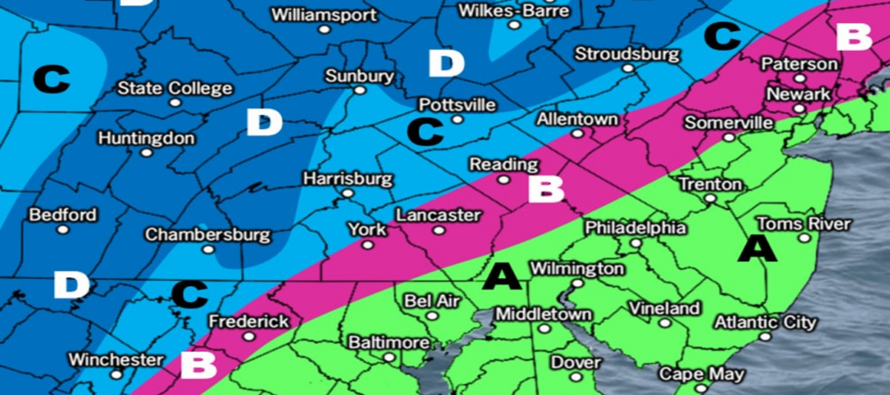
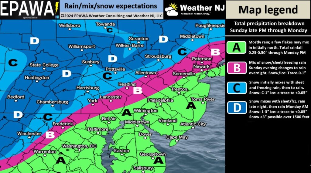
Precipitation is currently approaching from our W (visible in EPA on radar as of 1:30pm). I expect spotty showers to move in from W to E by late-afternoon/early evening and fill in throughout the rest of NJ between 7pm and midnight tonight (Sunday night). I’m much more confident in snow falling N of I-80/NW of I-287, especially for NWNJ elevations. It is possible, however, for snow to fall and accumulate as far S as N of I-78 but still NW of I-287. A reasonable expectation for said areas is a coating to an inch of snow accumulation with 1-3 inches possible for the higher elevations. NENJ could see snow mix in at times overnight into tomorrow (Monday) morning but likely without stickage. Everyone else to the S of I-78 should expect rain only as it will be well-above freezing. Here’s our snow/rain impact map for tonight through tomorrow.

Precipitation should take a small break between Monday morning and afternoon before more rain moves in (rain for all of NJ) for Monday afternoon into Tuesday morning. Total liquid precipitation between now and Tuesday is modeled between .75” and 1.25” (about .25” to .75 for tonight’s system) which will continue taking stabs at the recent drought situation.
I’m still monitoring the return of colder air around Dec 19-20 (after our Dec 16-19 milder period) along with a general coastal storm signal for the Dec 20-23 period. At the very least this period will be cold. Whether the storm hits or misses offshore is yet TBD but there’s still a storm signal showing despite models backing off from the historical solution they’ve kicked out in prior days. This should come into a more confident forecast window by Tuesday or Wednesday of this week.
In English: Rain is approaching from the W (snow likely for NWNJ elevations). Our above snow impact map lays out our evidence-based expectations for this evening through Monday morning. A cold rain for most of NJ but possibly a Monday morning of wintry delays and slower travel N of I-78/NW of I-287). Tomorrow’s weekly outlook will cover the milder period through at least Wednesday, the return of cold by the weekend, and a data update on the Dec 20-23 storm signal. Have a great rest of your Sunday and please be safe! JC
Premium Services
KABOOM Club offers ad-free content, inside info forecast discussion, your questions answered, and early storm impact maps and video releases (ahead of the public). At two bucks per month, it’s an extremely feasible way to show additional support for Weather NJ. Think of it as a tip jar with perks. Available onFacebook or Patreon.
My Pocket Meteorologist (MPM), in partnership with EPAWA Weather Consulting, offers professional/commercial interests, whose businesses depend on outdoor weather conditions (snow plowing, landscaping, construction, etc.), with hyper-local text message alerts/forecasts and access to the MPM premium forum—the most comprehensive and technical forecast discussion available for PA and NJ.
Jonathan Carr (JC) is the founder and sole operator of Weather NJ, New Jersey’s largest independent weather reporting agency. Since 2010, Jonathan has provided weather safety discussion and forecasting services for New Jersey and surrounding areas through the web and social media. Originally branded as Severe NJ Weather (before 2014), Weather NJ is proud to bring you accurate and responsible forecast discussion ahead of high-stakes weather scenarios that impact this great garden state of ours. All Weather. All New Jersey.™ Be safe! JC


