Feb 28: Strong Nor’easter Expected!

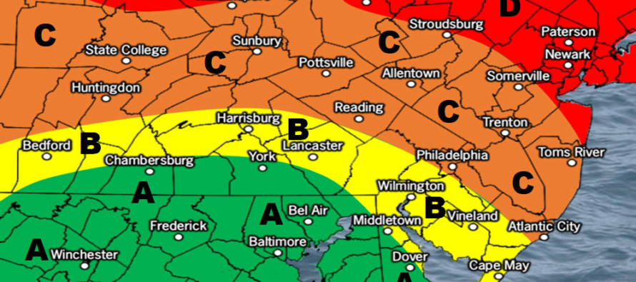
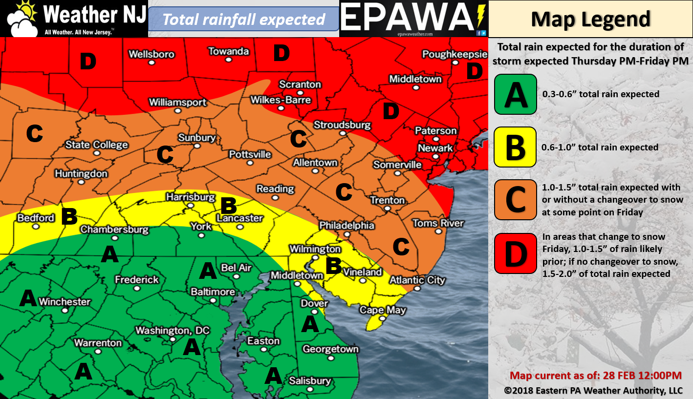
Rain Map:

Please click here for full-resolution rain map!
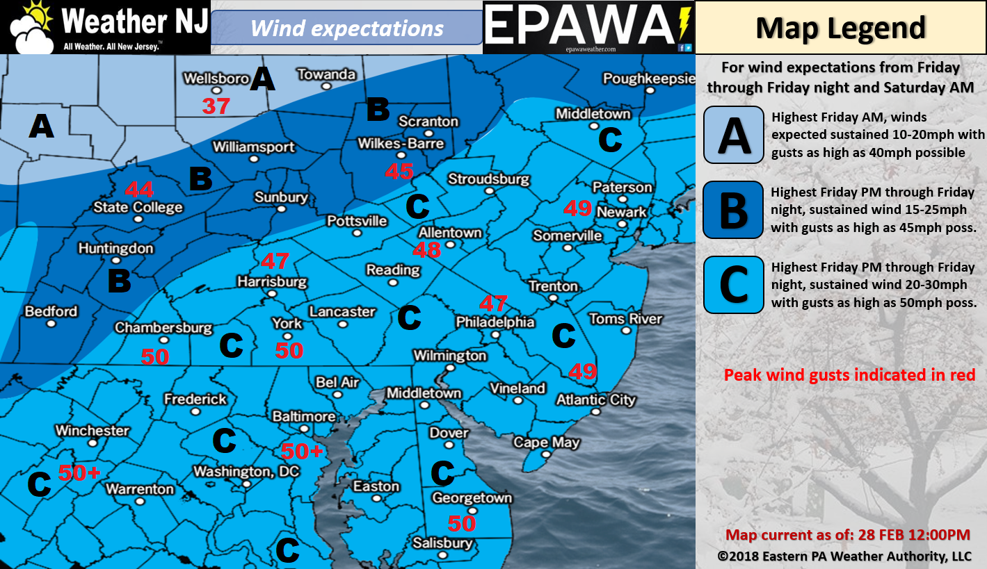
Wind Map:

Please click here for full-resolution wind map!
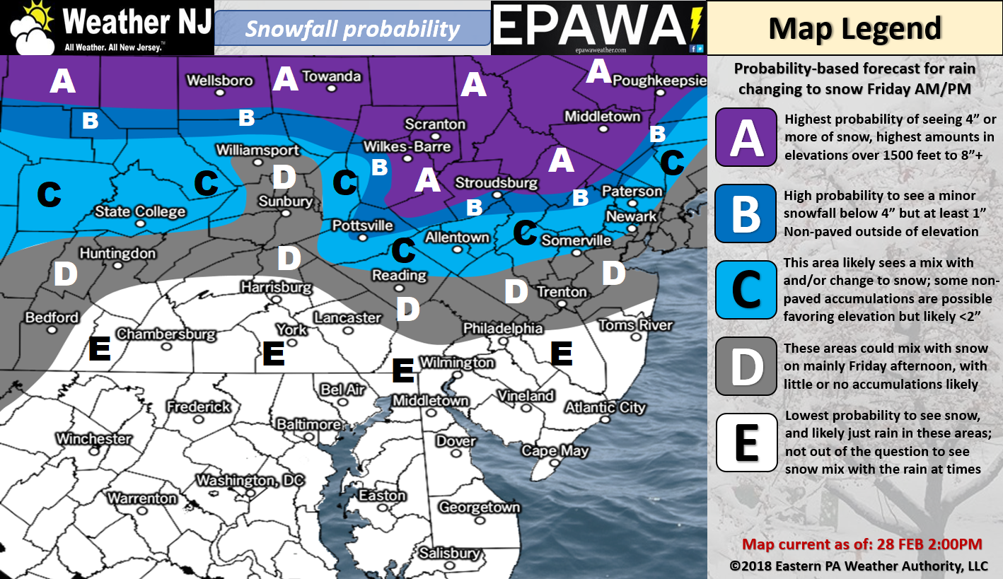
Snow Map:

Please click here for full-resolution snow map!
Discussion: I’m finding it very difficult to get a handle on the coastal flooding potential of this storm. Let’s talk about that last.
As far as rain goes, nothing biblical is expected here. Up to 2 inches or so in NNJ and up to an inch or so for SNJ. CNJ somewhere between. Worst case scenario…maybe 3 inches for NNJ and 2 inches for SNJ over the duration of the entire system Thursday PM to Saturday AM system. Rainfall should spread into NJ from SW to NE between Thursday afternoon and evening. Precipitation could end as snow likely between late-Friday PM and early Saturday AM.
As far as wind goes, we’re eventually going to have a powerful ocean storm to our E. The primary low is expected to first track to the Ohio/W PA area by Thursday evening. It should then transfer over NJ and redevelop somewhere just S of E Long Island/Cape Cod by Friday morning. The secondary low is the low that should bomb down to 980mb or so as it stalls, possibly retrogrades, near the 40N/70W benchmark Friday afternoon-ish. Lastly, the low encounters the strong blocking signal influence and tracks to the S/SE towards Bermuda. I’m not seeing any crazy winds Thursday into Friday morning. The higher winds gusts should occur Friday night into Saturday morning. Right now we’re thinking sustained winds of 20-30 with gusts to 50mph as our above wind map indicates. I would not be surprised to see gusts to 60mph as wildcard potential. 850mb winds are modeled very strong and those winds could get brought down as gusts, especially with all the lifting and correlating sinking of air that will be going on.
As far as snow goes, we have a lot working against accumulation including sun angle and climatology. This would be for Friday into early Saturday once (if) rain changes over to snow. Given the strength of the nor’easter however there are sufficient dynamics for the storm to make it’s own cold air via adiabatic expansion. Also heavier precipitation rates could over-power the expected warmer surface. This could end up producing anything from a rain/snow mix to a total paste job to a significant snow storm depending on the wildcard storm dynamics. Our first snow map above is a probabilities-based map. Tomorrow’s adjusted call will feature expected snowfall amounts.
Lastly let’s talk about coastal flooding. We have a Friday (March 2) full moon. This will naturally produce higher astronomical tides than usual for Friday and Saturday. Add a few inches of rainfall and wind-driven storm surge and it won’t take much to push above minor coastal flooding criteria into moderate criteria. The thing about this storm system is that Saturday looks worse for flooding than Friday. We should first see E/SE onshore flow develop Thursday PM but that transitions to N/NE flow rather quickly once the low makes the transfer. I’m expecting the heavier N/NE winds Friday night into most of Saturday. Normally, high N/NE winds would mean less of a flooding threat than usual as the flow is perpendicular most barrier island inlets. This system is different and tricky however due to the large swell flow that could remain out of the NE into the NJ coast. Therefore tidal guidance is very aggressive for both high tides that occur (Sat AM and Sat PM). I’m watching this very closely as we could be looking at moderate to major coastal flooding from this slowly-departing nor’easter. By Sunday PM, winds should begin subsiding out of the N with precipitation long-gone.
In English: A nor’easter is expected this weekend. Moderate-to-heavy rainfall is expected Thursday into Friday which could then end as snowfall Friday into Saturday morning. The jury is still out on snowfall accumulations but anything from just a mix (without accumulation) to pasty blizzard-like conditions are possible. We will find tune this for tomorrow’s adjusted update. Strong winds are also expected with the strongest gusts occurring between Friday afternoon and Saturday evening. Moderate, possibly major, coastal flooding is possible depending on where the nor’easter tracks after transferring out to sea and possibly retrograding back towards the coast. Saturday actually looks to feature the greatest coastal flooding risk surrounding the AM and PM high tides. Bottom line: The period between Thursday PM and Saturday AM should be quite interesting. Have a great night and please be safe! JC
For comprehensive and interactive hyper-local analysis that goes way above and beyond the detail of this public forecast, check out our premium services which include hyper-local text notifications from and guaranteed forum discussion with myself and Eastern PA Weather Authority (EPAWA).
Jonathan Carr (JC) is the founder and sole operator of Weather NJ, New Jersey’s largest independent weather reporting agency. Since 2010, Jonathan has provided weather safety discussion and forecasting services for New Jersey and surrounding areas through the web and social media. Originally branded as Severe NJ Weather (before 2014), Weather NJ is proud to bring you accurate and responsible forecast discussion ahead of high-stakes weather scenarios that impact this great garden state of ours. All Weather. All New Jersey.™ Be safe! JC


