Jan 31: Weather Update

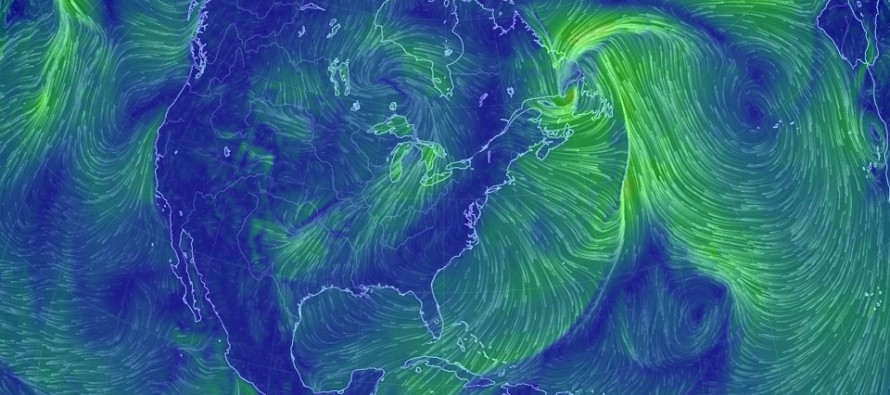
Discussion: I apologize for being offline for the last few days. I wanted to wait until today’s 12Z model suite populated to confirm the changes I’ve been seeing for the upcoming storm signals. They are as follows:
Thursday Night into Friday Morning (Feb 1-2): This still looks like a very weak wave of low pressure riding a frontal boundary. It’s still likely a rain to snow scenario however the amount of expected snow has trended from possibly significant to just light. Tomorrow we’ll start to warm up which should start all of NJ as rain by tomorrow evening. The changeover to snow would occur tomorrow overnight into Friday morning. I don’t think accumulations will be impressive however the rapid freeze potential should be considered. We have a very strong cold front pushing through which will set up a very cold Friday-Saturday. With any luck the dry NW flow/winds will evaporate most of the concern before it freezes.
Sunday into Monday (Feb 4-5): This system is still a strong synoptic storm signal however it has trended into a NWNJ-only wintry concern. Most along and SE of the I-95 corridor will likely end up too warm for snow accumulations, especially if the low tracks as close to the coast as currently modeled. Initial overrunning precipitation on Sunday afternoon could start as snow showers with light accumulations. By Sunday overnight however, strong onshore flow over 40F ocean water will likely prevent a snowy outcome for the lower 2/3 of NJ (outside of NWNJ elevations). NWNJ elevations are still in the game for an accumulating snow event. I’ll be monitoring this possibility for changes heading into this weekend but it does look like snow maps will have to be issued, especially for NWNJ and parts of E PA, should the status quo remain. The latest guidance ends precipitation closer to midnight Sunday night rather than going into the first part of Monday.
Wednesday-Thursday (Feb 7-8): This is the furthest-out possibility within the 7 day forecast period. As of right now it looks like another I-95 snow/rain line event but I do see a synoptic storm signal so I will continue to watch this period.
In English: February will kick off colder and more active as expected. We still need storm signals to time with the cold shots however and that doesn’t seem to be the case for the first week of February. The next few storm signals (listed above) are all showing unfavorable temperatures for big statewide snow events. Thursday into Friday is a rain to snow event with light accumulations possible statewide. Sunday into Monday looks like a snowy start region-wide with a changeover to rain for the lower 2/3 of NJ. NWNJ and interior Mid-Atlantic regions could still see accumulations and we’ll likely have to issue snow maps heading into the weekend. Next Wednesday-Thursday is then the next signal to watch but that too could split NJ with a snow/rain line near I-95. Beyond that February is still expected to be colder and more active. I’ll be watching for any periods where a storm signal times right with the cold. Until then there is nothing major to worry about. I’ll have the detailed Weekend Outlook posted tomorrow. Have a great night and please be safe! JC
For comprehensive and interactive hyper-local analysis that goes way above and beyond the detail of this public forecast, check out our premium services which include text notifications and forum access.
Jonathan Carr (JC) is the founder and sole operator of Weather NJ, New Jersey’s largest independent weather reporting agency. Since 2010, Jonathan has provided weather safety discussion and forecasting services for New Jersey and surrounding areas through the web and social media. Originally branded as Severe NJ Weather (before 2014), Weather NJ is proud to bring you accurate and responsible forecast discussion ahead of high-stakes weather scenarios that impact this great garden state of ours. All Weather. All New Jersey.™ Be safe! JC


