Aug 30: Irmagerd, Another One?

A hurricane is developing in the Atlantic Ocean. Let’s break it down…
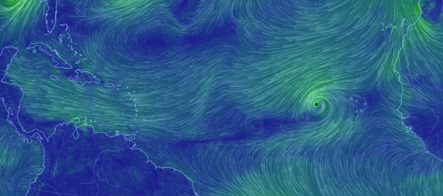
Discussion: Another tropical wave of low pressure has departed the Cape Verde Island region off W Africa. This system is rapidly organizing and already named by the NWS NHC (Tropical Storm Irma) as it heads towards the general NE Caribbean region, or as advanced hurricane trackers know as the “E Herbert Box.” Sustained winds are already up to 50mph. I wouldn’t be surprised to see category 1 hurricane status by tomorrow’s end. Most model guidance bombs this storm out into near-major hurricane status by the time it crosses the 45W longitude.
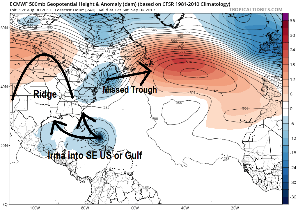
As far as steering currents go, Irma will duck under the first ridge of high pressure located to the E of Bermuda. This might turn Irma to the dead W, possibly even the W/SW a bit. An upper-level trough will then swing through the E US as Irma approaches. If Irma gets caught by the leading edge or bottom of the trough, she will likely stay out to sea and possibly threaten Bermuda with a landfall. However if Irma misses the trough completely then she could take another duck under the ridge trailing the trough over the E US. This would be the worst case scenario as US landfall would then become highly likely anywhere between OBX and the gulf coast.
So the key things I am watching for are Irma’s interaction with the first ridge, the middle trough and finally the trailing second ridge. I’m also watching how quickly Irma strengthens. This is what will ultimately determine Irma’s final trajectory as it transitions and curves from tropical E flow to the mid-latitude W flow. I will not have a good idea about this until later this weekend. Here’s the latest European model suggesting a southern route into the Bahamas by the end of the run. The key reason for the further S track on the euro is the slower development of Irma and little-to-no trough interaction:

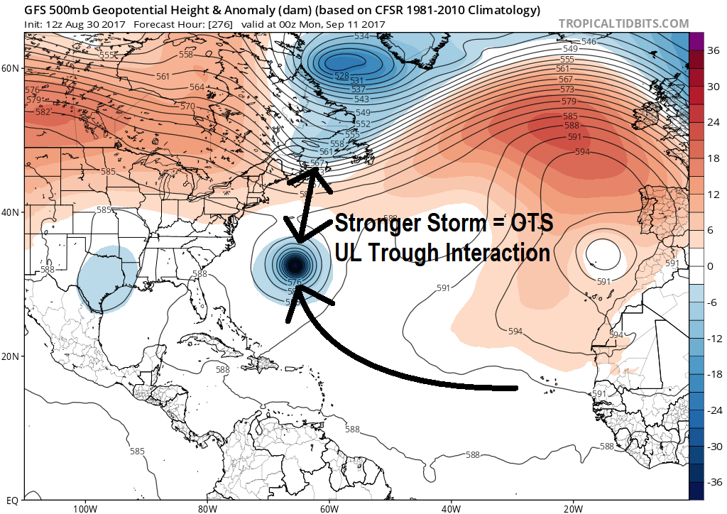
Today’s GFS has stronger amplification of Irma earlier in her track which results in a curvier track with slight upper-level trough interaction. This keeps Irma out-to-sea but slams Bermuda with a major hurricane hit:

I’m thinking the Euro is handling the upper-level pattern better at this point than the GFS but it’s far to early to commit to such a solution.
As far as timing goes, this system is expected to approach the NE Caribbean/Bahamas region in the Sept 5-8 period and then either the Bermuda, SE US coast, or Gulf of Mexico regions in the Sept 9-12 period depending on track. There’s a long way to go with this so no need to panic yet. For now, have this in the back of your mind as a period you might have to prepare for.
In English: Another hurricane (currently Tropical Storm Irma) is brewing in the Atlantic Ocean and it looks to become a powerful one. It should track across the Atlantic Ocean from E to W towards the NE Caribbean/Bahamas area by September 5-8. That will be a critical point of analysis regarding where Irma will go from there. Anything is on the table including an out-to-sea miss (possible Bermuda hit), an east coast hit or possibly entrance into the Gulf of Mexico. Should it all work out to an east coast hit, the timing would likely be in the September 9-12 period. This is all I can state for now with confidence but I can assure you that I’m watching this system very closely. Be safe! JC
Jonathan Carr (JC) is the founder and sole operator of Weather NJ, New Jersey’s largest independent weather reporting agency. Since 2010, Jonathan has provided weather safety discussion and forecasting services for New Jersey and surrounding areas through the web and social media. Originally branded as Severe NJ Weather (before 2014), Weather NJ is proud to bring you accurate and responsible forecast discussion ahead of high-stakes weather scenarios that impact this great garden state of ours. All Weather. All New Jersey.™ Be safe! JC


