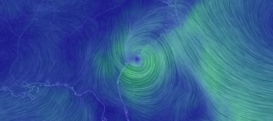
May 29: Bonnie Weakens. Wet Memorial Day

Bonnie reached tropical storm criteria yesterday but has since weakened into a tropical depression. It will stall in the coastal South Carolina area for a few days before eventually being lifted out to the NE early next weekend by a frontal boundary passage. Our more-immediate concern is an area of precipitation that will break off of the weakening storm and slide up a frontal boundary passage tonight through early Tuesday morning.
This makes Monday a rainy day with anything from .75 to 1.75 inches of rainfall possible. This rainfall might have a drenching tropical feel to it so it could be heavy at times. With that said, flash flooding is also possible. Another thing to consider is any thunderstorm activity that forms along the frontal boundary itself. Such activity would likely be embedded within the widespread rainfall and we’ll have to pay attention to any winds that get kicked up.
In English: Memorial Day Weekend had a good run with a few summery days leading up to and through today. Tomorrow however will not be a good outdoor day as moderate-to-heavy rainfall and possibly embedded thunderstorms are possible. The good news is that pleasant weather is expected this week once everything clears by early Tuesday morning. I’ll post a Tuesday-Friday outlook tomorrow evening. Have a great rest of your Memorial Day Weekend and please be safe! JC
Jonathan Carr (JC) is the founder and sole operator of Weather NJ, New Jersey’s largest independent weather reporting agency. Since 2010, Jonathan has provided weather safety discussion and forecasting services for New Jersey and surrounding areas through the web and social media. Originally branded as Severe NJ Weather (before 2014), Weather NJ is proud to bring you accurate and responsible forecast discussion ahead of high-stakes weather scenarios that impact this great garden state of ours. All Weather. All New Jersey.™ Be safe! JC


