April 2: Listen to the Wind Blow. Watch the Sunrise!

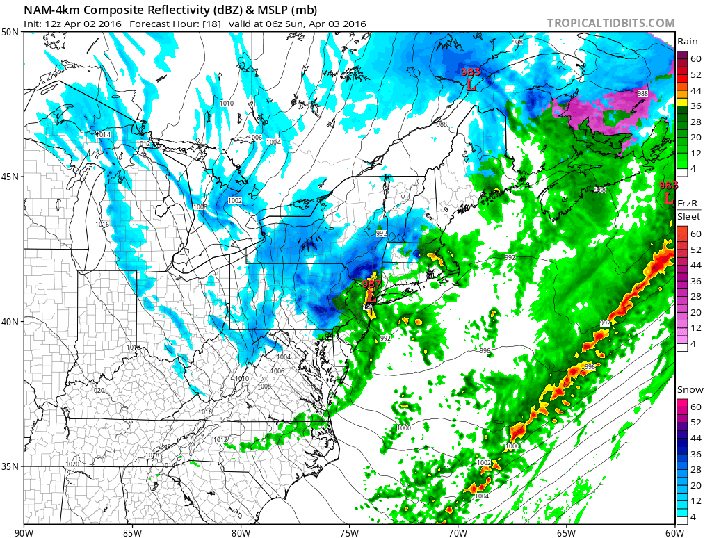
Those are some of my favorite Fleetwood Mac lyrics and are well-suited for tomorrow morning. A low pressure disturbance, currently over the Great Lakes, will be making a pass through our region overnight. It should track right over the NNJ/NYC area in the early AM hours of Sunday with an intensity of 987mb, possibly slightly lower. Whenever a synoptic low of this nature is expected to dip sub-990mb, higher wind gusts are generally expected. It should form a frontal passage to it’s south with rain and snow showers possible along such. I see no reason why a few cracks of lightning aren’t possible but dropping temperatures and wind gusts should own the headlines. Here’s the latest high-res NAM showing precipitation and pressure gradients between 8PM tonight and 2AM Sunday morning:
Precipitation associated with the current weak disturbance to our south should end this afternoon from W to E. We should then see a lull in precipitation until the stronger system approaches later tonight. Winds should be breezy-to-gusty out of the W today until that frontal passage approaches. Along and behind the frontal passage should see even stronger winds out of the W/NW and ultimately N/NW as the colder air mass is ushered in to our region through the early part of the week. With that said, wind gusts of 50mph or greater are possible between later tonight and tomorrow night with sustained winds holding between ~20-30mph. Tomorrow morning should see the peak wind gust conditions. Winds should then gradually subside heading into overnight hours tomorrow night.
In English: Current rain should end through afternoon hours. We should then see a lull in rainfall until later tonight. Overnight precipitation could be short-lived, starting as rain and possibly ending as snow with little to no accumulations expected. The bigger story will be the wind which should howl from tonight through tomorrow morning and well into Sunday. After this rain clears out this afternoon, it’s a good time to secure anything loose that might blow away. Everyone have a great Saturday-Sunday, please be safe and never break the chain! JC
Jonathan Carr (JC) is the founder and sole operator of Weather NJ, New Jersey’s largest independent weather reporting agency. Since 2010, Jonathan has provided weather safety discussion and forecasting services for New Jersey and surrounding areas through the web and social media. Originally branded as Severe NJ Weather (before 2014), Weather NJ is proud to bring you accurate and responsible forecast discussion ahead of high-stakes weather scenarios that impact this great garden state of ours. All Weather. All New Jersey.™ Be safe! JC


