Feb 15: Monday Night Observations

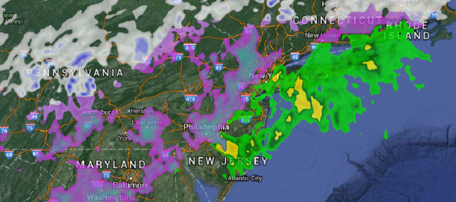
Most precipitation has changed over from snow to either sleet, freezing rain or plain rain depending on where you are. Most of SENJ has spiked into the 40s and should be all rain from hereon out. Parts of SWNJ and WCNJ are still at or just below freezing with on and off freezing rain. NNJ, especially NWNJ is still in the teens and 20s also with pockets of freezing rain moving through.
I don’t think even NWNJ will see any more snow due to the warming of the lower-mid levels. The ice should be the primary concern overnight and through sunrise, primarily for EPA and NWNJ elevations. Ice accumulations through said areas could easily reach into the .10 to .25 of an inch range. This could cause power issues due to the additional weight of ice on tree branches and power lines. It could also make roads very dangerous to travel on through the AM rush hour.
Later tomorrow morning through afternoon should feature the final rainy stage of this overall system. Moderate to heavy rainfall is possible (separate from and in addition to today’s precipitation) with anything from .75 to 2 inches of rain possible statewide. I do have a small concern for run-off/flash flooding. I also wouldn’t be surprised to see some embedded rumbles when the final band of rain comes through. Winds should be gusty out of the S until the low passes by. We’ll then taper off tomorrow afternoon into evening hours and temperatures will stay mild overall into the weekend.
In English: The snow is mostly over. Now areas NW of the turnpike should experience freezing rain overnight while points SE continue to see plain rain and 40-degree+ temperatures. Eastern PA and parts of NWNJ look like the heaviest icing threats overnight and into the morning hours. Tomorrow we should see heavy plain rain through afternoon hours with balmy-feeling temperatures before drying out tomorrow evening. Have a great night and be safe! JC
Jonathan Carr (JC) is the founder and sole operator of Weather NJ, New Jersey’s largest independent weather reporting agency. Since 2010, Jonathan has provided weather safety discussion and forecasting services for New Jersey and surrounding areas through the web and social media. Originally branded as Severe NJ Weather (before 2014), Weather NJ is proud to bring you accurate and responsible forecast discussion ahead of high-stakes weather scenarios that impact this great garden state of ours. All Weather. All New Jersey.™ Be safe! JC


