Oct 26: Moderate Rain and Wind Detected!

We’re looking at a decent, but not crazy, amount of rainfall this week. We can thank the remnants of Patricia for this. The leftover energy will move northward from the Gulf States amd absorb into an upper level trough that should swing through the Great Lakes and NE US. The bottom tip of the trough will virtually kiss our region as it swings through. What does this mean for us?
Total modeled precipitation appears to be between 1-3 inches of rainfall starting as early as late Tuesday night and ending as late as early Thursday AM. Most of this rainfall should naturally fall on Wednesday.
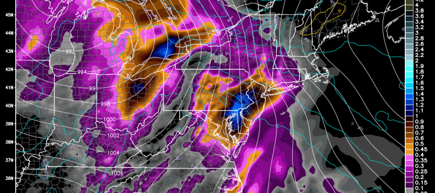
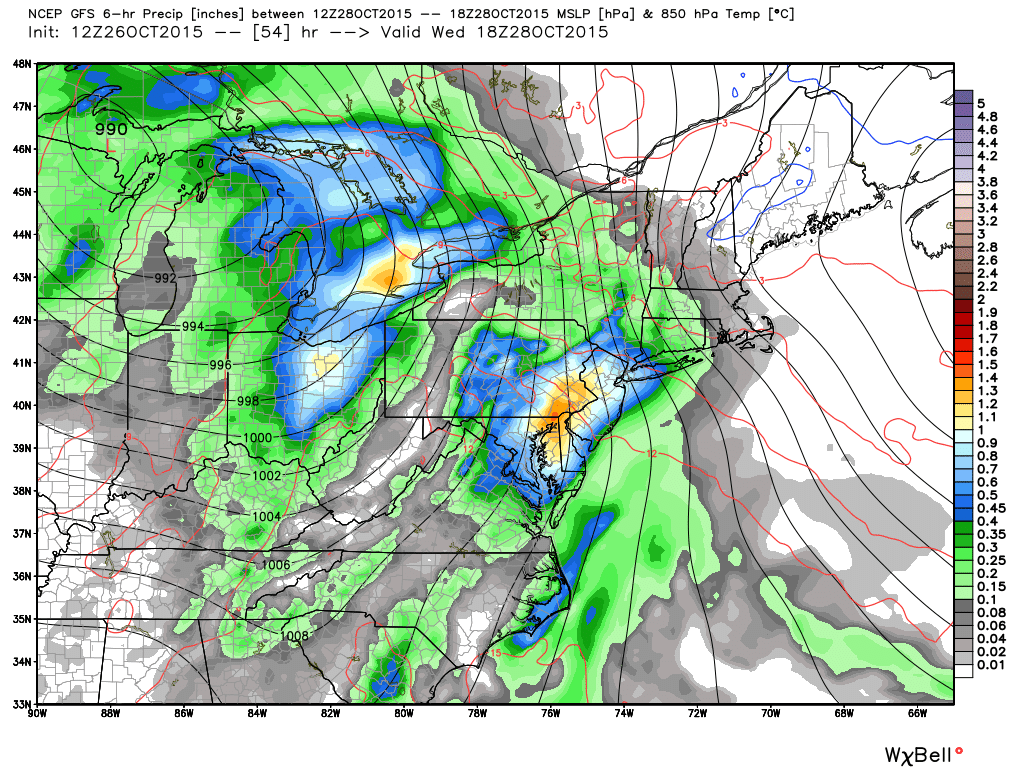
As far as wind goes, a powerful upper level low will form near the Great Lakes and lift up into E. Canada. This will include Patricia’s absorbed energy. Right now, that low looks to drop below 980mb as it pulls away to the NE. This should create a decent wind field over a large diameter of geographic area. It will be felt moreso closer to the Great Lakes/E. Canada but will still reach New Jersey with likely 30-40mph wind gusts just before, during and just after the expected rainfall. Here’s the key frame of the 12Z GFS showing precipitation, temperature, and pressure at 850mb between 8am and 2PM on Wednesday:
So basically, you can expect a run-of-mill rain and wind event in New Jersey between Tuesday night and early Wednesday AM with the majority of action occurring on Wednesday. 1-3 inches of rainfall over the course of 24-36 hours. Wind gusts in the ball park of 30-40mph starting from the S and ending from the W/NW. Make sure to have any outside Halloween decorations secured. We need the rain even though this will likely have little impact on our drought. The good news is that this should set up a nice and dry Friday-forward with high pressure moving in to dominate Halloween Weekend. I’ll have the full weekend outlook posted on Thursday but that’s what it looks like right now. Be safe! JC
Model images reproduced with permission from WeatherBell Analytics.
Jonathan Carr (JC) is the founder and sole operator of Weather NJ, New Jersey’s largest independent weather reporting agency. Since 2010, Jonathan has provided weather safety discussion and forecasting services for New Jersey and surrounding areas through the web and social media. Originally branded as Severe NJ Weather (before 2014), Weather NJ is proud to bring you accurate and responsible forecast discussion ahead of high-stakes weather scenarios that impact this great garden state of ours. All Weather. All New Jersey.™ Be safe! JC


