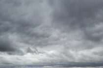
A Mixed Bag of Conditions
Discussion: The upper jet should dip over NJ this weekend but not too far S of NJ…more right over as a weak trough. This will allow a disturbance to pass through and bring rain, possibly thunderstorms, to NJ between late


Discussion: The upper jet should dip over NJ this weekend but not too far S of NJ…more right over as a weak trough. This will allow a disturbance to pass through and bring rain, possibly thunderstorms, to NJ between late

Discussion: This entire week in NJ should occur under positive height anomalies. This means mild conditions at the surface with little rain outside of passing spring showers here and there. The next rain system looks to arrive late Friday night

Discussion: The foreseeable upper-level pattern indicates alternating ridging and zonal flows. At the lower levels this means sustained spring warmth. Expect a hotter day Saturday (tomorrow) followed by Sunday-Monday in the 60s. But after that it looks like every day

Discussion: Another trough will pass through midweek, producing cooler conditions for ~Wednesday. But before and after that look mild with temps into 60s for most areas. The arrival of the trough could produce some showers and thunderstorms late tonight/Tuesday. Saturday

Discussion: Isn’t it funny how you can go all of March without wintry precipitation (most areas) and then have to deal with some in April? It’s downright nasty outside right now. Cold and rainy and that should be the case
Discussion: A trough is swinging into place over the NE US. It’s not a deep nor negative tilted trough but certainly packed with below-average temperatures for the region which will influence NJ this week. Much of our precipitation the last

Discussion: This weekend’s weather pattern will mostly be controlled by ridging over the east coast supported by a stubborn Bermuda high. NJ will on the NW side of the ridge which means a few things. First, there is convergence driving

LOCAL FORECAST | INTERACTIVE RADAR | LATEST NJ WEATHER ALERTS | WEDDING FORECAST| PRIVACY POLICY
© Copyright 2025 Weather NJ LLC. All Rights Reserved.
Some information that can be found on our website is provided by a private weather station and is not an officially recognized station for weather reporting. Though we always strive to achieve accurate reporting for our own use, it is important that you do NOT depend on the data provided here for any purpose.


