Small Window of Relief (Aug 7-9)

Small Window of Relief (Aug 7-9)

🕔15:42, 6.Aug 2020

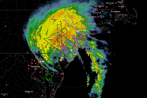
Discussion: There’s nothing really worth discussing in the upper-levels. 250mb jet analysis and 500mb geopotential height analysis indicate no major features to worry about. The main player this weekend will be an area of high pressure tracking from the Great

Read Full Article
Aug 4: Isaias is Here

Aug 4: Isaias is Here

🕔12:03, 4.Aug 2020

Discussion: Hope everyone is staying safe out there! The eye of Isaias remnants is currently moving from N Delaware into SWNJ. This will calm the winds for SWNJ but NNJ and CNJ will remain under gusty E winds while SENJ

Read Full Article
Aug 3: Tropical Storm Isaias Approaching

Aug 3: Tropical Storm Isaias Approaching

🕔16:46, 3.Aug 2020

Discussion: Isaias is a strong tropical storm located just E of the SC/GA coastal border. Sustained winds were last recorded at 70mph with higher gusts. It has a small chance for slight intensification during its last breath over warm water.

Read Full Article
Aug 2: Isaias Impact on NJ

Aug 2: Isaias Impact on NJ

🕔22:43, 2.Aug 2020

Discussion: Isaias is currently just off the east coast of central Florida as a strong tropical storm. Its steering will now be heavily influenced by the trough spanning from the Great Lakes down through the TN valley. The front of

Read Full Article