Cold but Dry Weekend Expected (Feb 27-Mar 1)

Cold but Dry Weekend Expected (Feb 27-Mar 1)

🕔13:23, 26.Feb 2015

We’re cold through overnight Saturday with the entire state staying below freezing for lows and highs. A few more nights of single digit temperatures are likely. On Sunday we begin to moderate some with 50s possible next week. There are also a

Read Full Article
Feb 25: Snow Map for Tomorrow

Feb 25: Snow Map for Tomorrow

🕔14:10, 25.Feb 2015

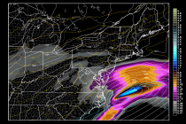
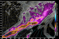
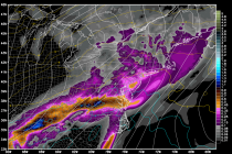
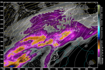
The map is pretty straight forward. Snow arrives from the S/SE overnight and clears out by noon at the latest tomorrow. A nuisance for most of NJ but possible significant impact to extreme SENJ. Be safe! JC Jonathan CarrJonathan Carr

Read Full Article
Feb 25: SENJ Snow Likely Thursday AM

Feb 25: SENJ Snow Likely Thursday AM

🕔09:56, 25.Feb 2015

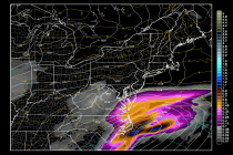
Model guidance has continued to nudge precipitation northwestward into SENJ. Cumberland, Cape May, Atlantic, and SE parts of Ocean and Burlington Counties have the best chance to see light to moderate snowfall between 4AM and 10AM tomorrow. Snow showers are now reaching

Read Full Article
Feb 24: Watching Thursday Morning

Feb 24: Watching Thursday Morning

🕔10:13, 24.Feb 2015

The storm that was modeled last week for this Wednesday-Thursday shifted southward over this past weekend. Over the last 24 hours it has trended slightly back northward and shifted potential impacts for SENJ closer to the 2AM-11AM Thursday morning period. We

Read Full Article
NJ Long Range Outlook – Spring is Just Ahead!

NJ Long Range Outlook – Spring is Just Ahead!

🕔14:40, 23.Feb 2015

It’s time to harness the true power of WeatherTrend360’s proprietary algorithms again as we begin to close out Winter. First lets break New Jersey into proper climatological regions. We have the upper elevations of NWNJ, the interior coastal plain (SWNJ through CNJ and into

Read Full Article
Old Man Winter Keeps His Grip (Feb 23-27)

Old Man Winter Keeps His Grip (Feb 23-27)

🕔10:15, 23.Feb 2015

Another week of colder-than-average temperatures is expected with some wintry precipitation possible in the Wednesday-Thursday period. Let’s take a look at each day: Monday will top out in the upper teens (NWNJ) to  20s (SENJ) for high temperatures. Expect a mixed

Read Full Article
Feb 20: Weekend Storm Update

Feb 20: Weekend Storm Update

🕔19:31, 20.Feb 2015

Model guidance continues to show more of a front end snow thump tomorrow afternoon-evening before changing over to sleet/freezing rain and ultimately rain by Sunday morning. Here’s my latest impact map/update. The darker blue area should stay snowy the longest and

Read Full Article
Another Wintry Weekend Expected (Feb 20-22)

Another Wintry Weekend Expected (Feb 20-22)

🕔10:08, 20.Feb 2015

  Friday should top out around 15 statewide with plenty of sunshine. Expect 10-15mph winds out of the NW with gusts to 30mph. Wind chill factors should continue to be brutal. Overnight lows then range from -5 in NWNJ to

Read Full Article
Feb 19: Weekend Storm Update

Feb 19: Weekend Storm Update

🕔16:02, 19.Feb 2015

First and foremost, prepare for a very cold overnight period tonight. The Arctic front is well out to sea and Arctic high pressure will re-enforce the cold air mass through Saturday morning. We’re looking at single-digit lows (if not lower)

Read Full Article
Feb 18: Weekend Rain Detected

Feb 18: Weekend Rain Detected

🕔16:55, 18.Feb 2015

A low pressure disturbance will sneak between two Arctic air masses this Saturday night into Sunday. The central low pressure track will likely be just west of/along the Appalachian Mountains which traditionally spells rain for New Jersey and nearby surrounding

Read Full Article